Grafham Water
Reservoir in CambridgeshireGrafham Water is an 806.3-hectare (1,992-acre) biological Site of Special Scientific Interest (SSSI) north of Perry, Huntingdonshire. It was designated an SSSI in 1986. It is a reservoir with a circumference of about 16 km (10 mi), is 21 m (69 ft) deep at maximum, and is the eighth largest reservoir in England by volume and the joint third largest by area at 6.27 km2. An area of 114 ha at the western end is a nature reserve managed by the Wildlife Trust for Bedfordshire, Cambridgeshire and Northamptonshire.
Read article


Top Questions
AI generatedMore questions
Nearby Places
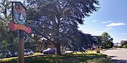
Perry, Cambridgeshire
Village in Cambridgeshire, England

Grafham, Cambridgeshire
Village in Cambridgeshire, England

Shepherd's Close

Gaynes Hall
Country house in Perry, Cambridgeshire, England

HM Prison Littlehey
Prison in Cambridgeshire, England

Grafham railway station
Former railway station in Cambridgeshire, England
Stonely Priory
Augustinian priory in Cambridgeshire, England

Perry Woods